A Morning That Turned Into a National Emergency
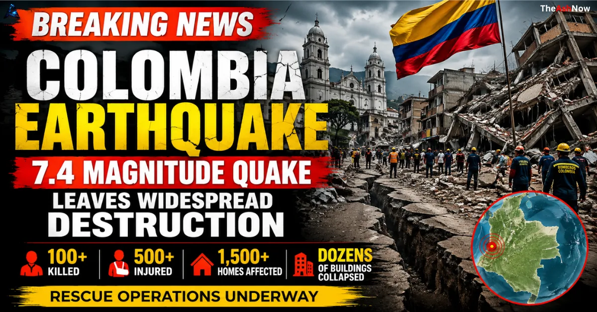
A powerful magnitude 7.4 earthquake struck western Colombia at approximately 7:34 a.m. local time on Monday, August 10, 2026, transforming an ordinary morning into one of the country’s most serious natural disasters in years.
The earthquake was centered near San José del Palmar in the department of Chocó, at a depth of roughly 107 kilometers, according to reports citing the U.S. Geological Survey. Although the epicenter was not located directly beneath one of Colombia’s largest cities, strong shaking was felt across a wide portion of the country, including major urban centers such as Cali, Pereira, Manizales, Quibdó and Armenia. Tremors were also felt beyond Colombia’s borders.
The human toll escalated rapidly throughout the day. Early reports spoke of dozens of deaths, but later updates pushed the reported death toll beyond 100. One of the latest widely cited Colombian reports put the toll at at least 132 people killed and 570 injured, while other major international reports at different stages reported lower totals. That discrepancy is normal in the immediate aftermath of a major disaster, particularly when rescue teams are still searching collapsed structures and communications have been disrupted.
The disaster was serious enough for the Colombian government to declare a national emergency/disaster response, mobilizing emergency resources while rescue operations continued in several cities.
Your Leadership Story Deserves the Spotlight
Get featured on TheAshNow — the editorial platform trusted by founders, CEOs & executives worldwide for Google visibility, LinkedIn authority & global recognition.
Apply for Featured Profile →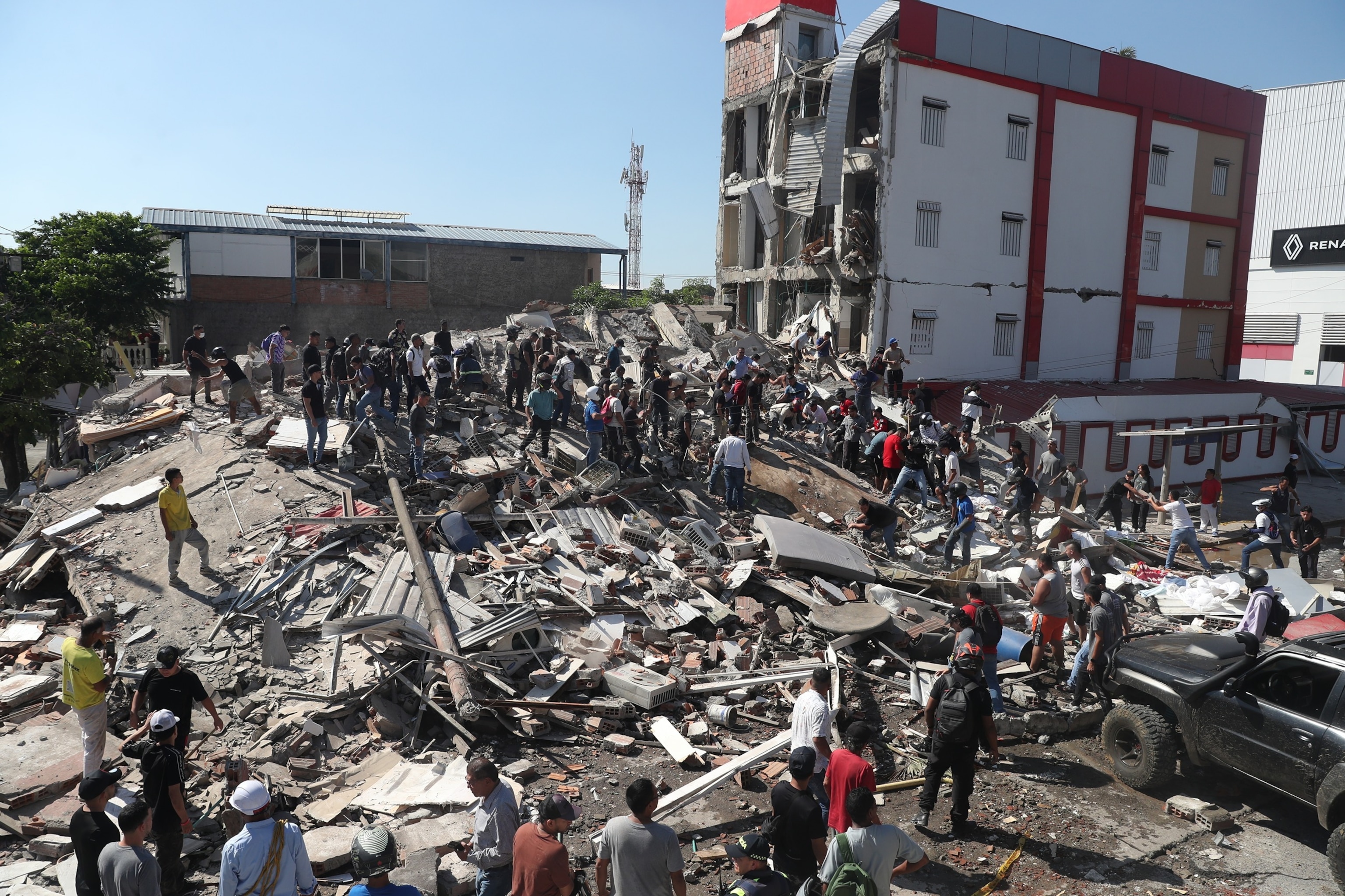
What made the earthquake especially devastating was not simply its magnitude. It was the combination of powerful shaking, vulnerable structures, densely populated urban areas, damaged infrastructure, and the difficulty of reaching some of the hardest-hit locations.
Table of Contents
What Exactly Happened in Colombia?
Earthquakes occur when accumulated stress in the Earth’s crust is suddenly released along a fault or within a tectonic plate. That movement sends seismic waves outward from the rupture zone.
The Colombian earthquake registered at 7.4 magnitude, a level representing a very large earthquake capable of causing severe damage under the right conditions. Importantly, magnitude is logarithmic: an increase of one whole magnitude represents roughly 32 times more energy release.
The August 10 earthquake occurred at substantial depth, approximately 107 kilometers beneath the surface. A deep earthquake can behave differently from a shallow earthquake. A shallow earthquake can produce extremely destructive ground motion near the rupture, while a deeper earthquake can allow seismic energy to travel over a much broader area.
That broad reach helps explain why this was not simply a localized disaster around Chocó. Communities many hundreds of kilometers away reported powerful shaking.
The epicenter was reported in or near the San José del Palmar area of Chocó, roughly west of Bogotá. Chocó is geographically complex, heavily forested and comparatively difficult to access in many places. That presents a serious logistical challenge after any major disaster.
Why a 7.4 Earthquake Is Considered Extremely Powerful
A magnitude of 7.4 is not just “a strong tremor.” It represents a major seismic event.
The energy released by an earthquake rises dramatically as magnitude increases. That is why the difference between magnitude 6 and magnitude 7 is far greater than the numbers suggest. At 7.4, an earthquake is capable of widespread structural damage, infrastructure disruption, landslides and serious casualties, particularly where buildings are vulnerable, or emergency services are overwhelmed.
However, magnitude alone does not determine the number of people killed.
BUILD YOUR LEGACY IN PRINT
Editorial features for founders, CEOs & executives — engineered for search visibility, LinkedIn credibility & industry authority.
APPLY NOW →Two earthquakes with the same magnitude can produce completely different death tolls. Their consequences depend on:
- depth;
- distance from major population centers;
- local geology and soil conditions;
- building construction;
- time of day;
- population density;
- preparedness;
- emergency response capacity;
- and whether critical infrastructure fails.
That is why understanding the Colombian earthquake requires looking beyond the 7.4 number.
The Geography of the Epicenter Matters
The epicenter near San José del Palmar lies in western Colombia’s mountainous and biologically complex territory, far from the country’s administrative and economic center in Bogotá.
That geography created a difficult paradox.
The epicenter was not directly underneath Colombia’s largest city, but powerful seismic waves traveled into much more populated regions. At the same time, the department containing the epicenter includes communities where access can be difficult even under normal circumstances.
Remote roads, mountainous terrain, communication interruptions, and damaged infrastructure can slow rescue teams precisely when minutes matter most.
This is one reason early casualty estimates can be particularly unreliable in disasters centered in geographically difficult regions. A lack of confirmed information does not necessarily mean an area is unharmed. It may mean rescue teams have not yet reached it or communication systems are temporarily down.
That concern was particularly relevant to parts of Chocó after the earthquake.
Cali Becomes One of the Main Urban Disaster Zones
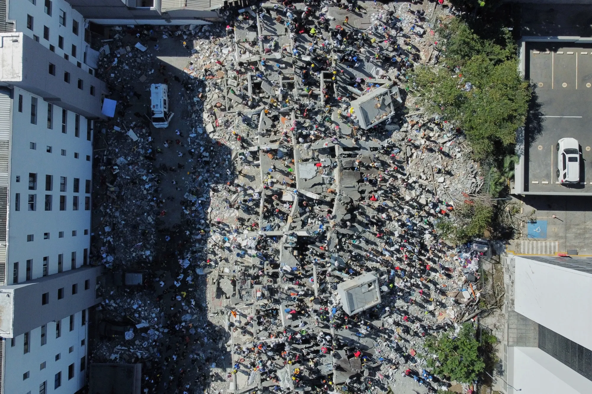
Among the major cities affected, Cali emerged as one of the most significant centers of damage and rescue activity.
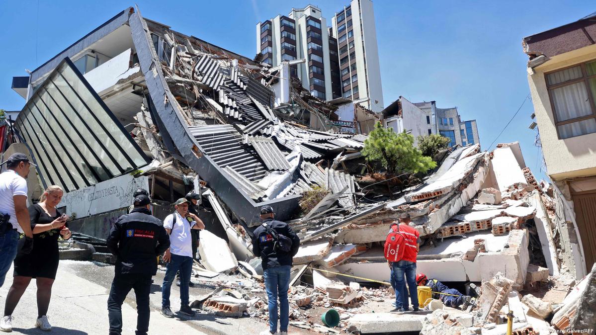
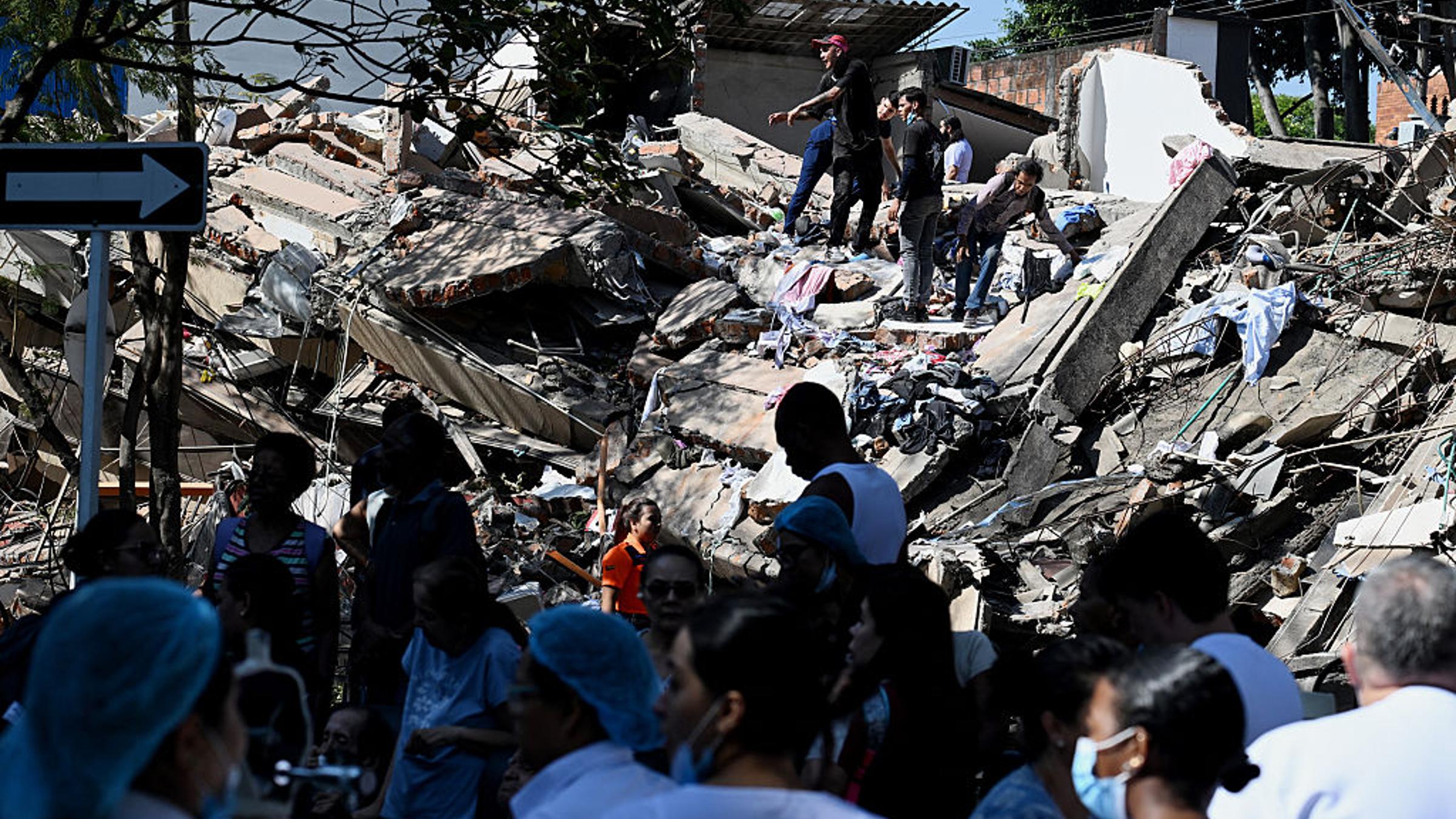
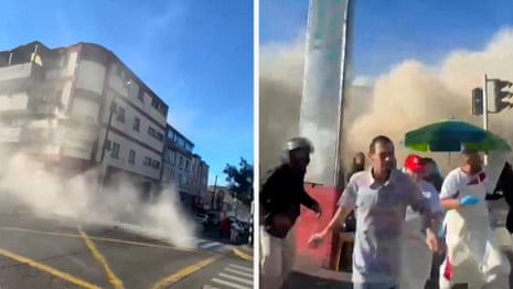
Cali is Colombia’s third-largest city and a major economic and cultural center. The earthquake caused structural failures across parts of the city, and authorities reported numerous collapsed or heavily damaged buildings.
Reports from the city’s administration described at least 30 structures collapsing, with rescue teams working at several locations where people were believed to be trapped.
The scenes were a reminder of one of the most dangerous realities of major earthquakes: the disaster does not necessarily end when the ground stops moving.
People can remain alive inside collapsed buildings for hours or even days. That turns the period immediately after the earthquake into a race against time.
Rescuers must carefully balance speed against safety. Pulling unstable debris too aggressively can trigger secondary collapses. Heavy machinery can help remove large concrete sections but can also create vibrations that threaten trapped survivors.
That is why professional urban search-and-rescue operations frequently involve a mixture of cranes, cutting tools, rescue dogs, acoustic equipment, cameras and, in the most delicate areas, nothing more than human hands.
Pereira and the Coffee Region Were Also Hit Hard
The earthquake’s effects were not confined to Cali.
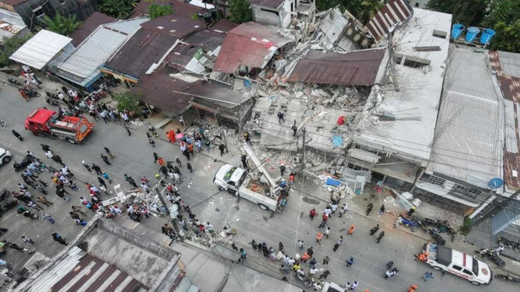
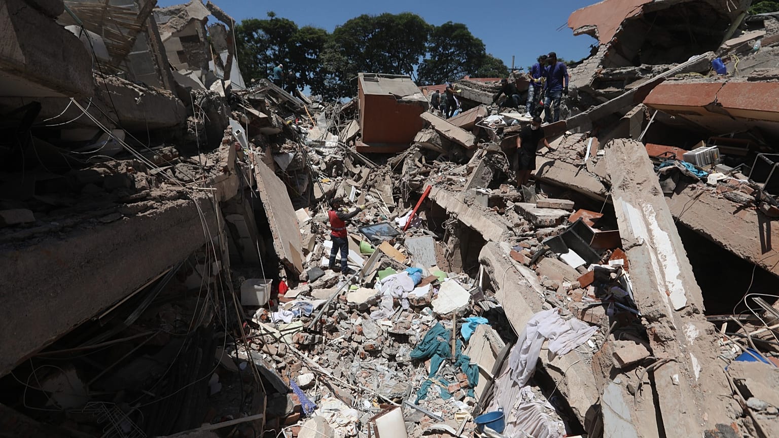
Pereira, located in Colombia’s coffee-growing region, suffered significant casualties and structural damage. Reports indicated that the city and surrounding metropolitan area accounted for a major share of the fatalities.
One report from The Guardian cited 40 deaths in Pereira, while other reports later placed the national death toll even higher as authorities compiled information from different municipalities.
The wider region includes cities with substantial populations, dense construction and older structures. An earthquake affecting the coffee-growing heartland can therefore produce consequences far beyond individual building collapses.
Hospitals become especially vulnerable. A hospital that suddenly receives hundreds of injured people is also dealing with its own crisis: broken windows, damaged corridors, power interruptions, displaced patients, frightened staff and possible structural concerns.
Some hospitals in affected areas reportedly had to evacuate or relocate patients after the shaking.
Hospitals Were Forced Into Emergency Mode
A severe earthquake creates a unique medical emergency because the number of casualties can arrive almost simultaneously.
Ordinary emergency rooms are designed to handle a certain volume of patients. A major earthquake can produce a sudden surge involving trauma victims with fractures, crush injuries, head trauma, internal bleeding, burns, and respiratory complications.
At the same time, medical facilities may themselves suffer damage.
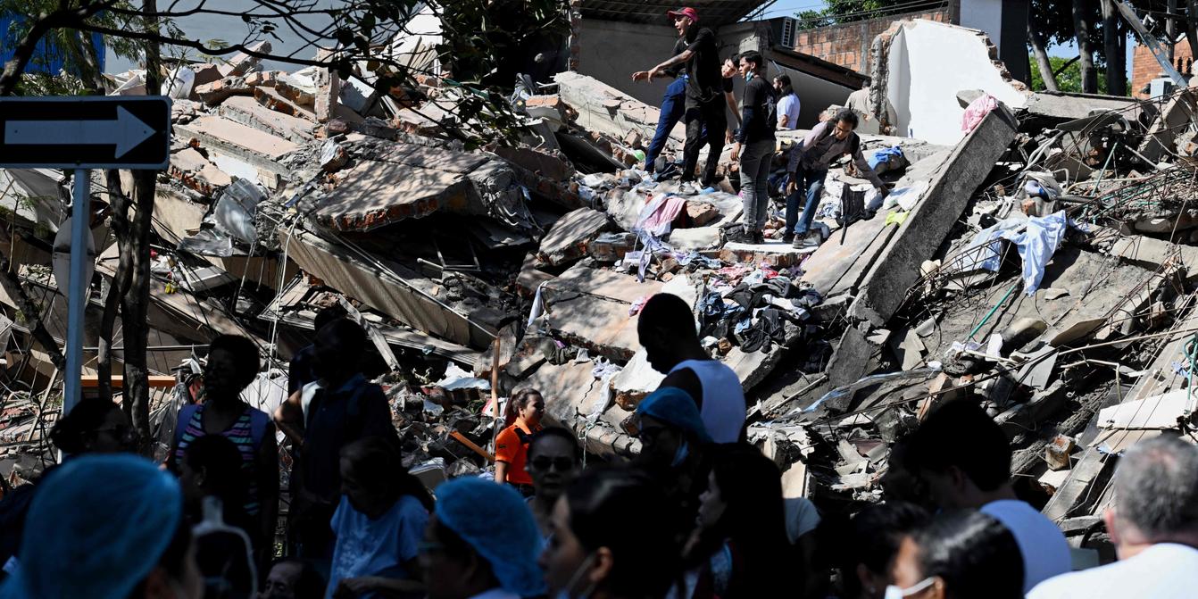
Reports from Colombia described hospital evacuations and disruption as medical workers attempted to continue treating patients under difficult circumstances. In some locations, patients had to be moved outdoors or to safer areas while structures were assessed.
The first medical priority after an earthquake is not always treating every injury immediately. Hospitals may have to implement disaster triage, prioritizing patients according to the urgency and survivability of their conditions.
This is one of the hardest dimensions of disaster medicine: doctors and nurses may have to make decisions in minutes that would be unthinkable in normal circumstances.
The Rescue Operation Is Now the Most Important Story
Once an earthquake of this scale happens, the next 24 to 72 hours become critical.
Rescue operations typically unfold through several stages.
First comes rapid assessment: identifying collapsed buildings, casualties, blocked roads, damaged bridges and areas without communication.
Then comes search and rescue.
Specialist teams try to locate survivors using visual inspection, listening equipment, thermal technology, cameras and trained dogs. Survivors trapped under rubble can sometimes survive for extended periods, particularly when they have access to breathable air and are protected from severe crushing injuries.
But conditions can deteriorate rapidly.
Dust can damage the lungs. Water becomes a problem. Injuries can worsen. Night temperatures can create additional risks. Secondary collapses can kill both survivors and rescuers.
For that reason, earthquake rescue is not simply about removing debris as quickly as possible. It is a highly technical operation.
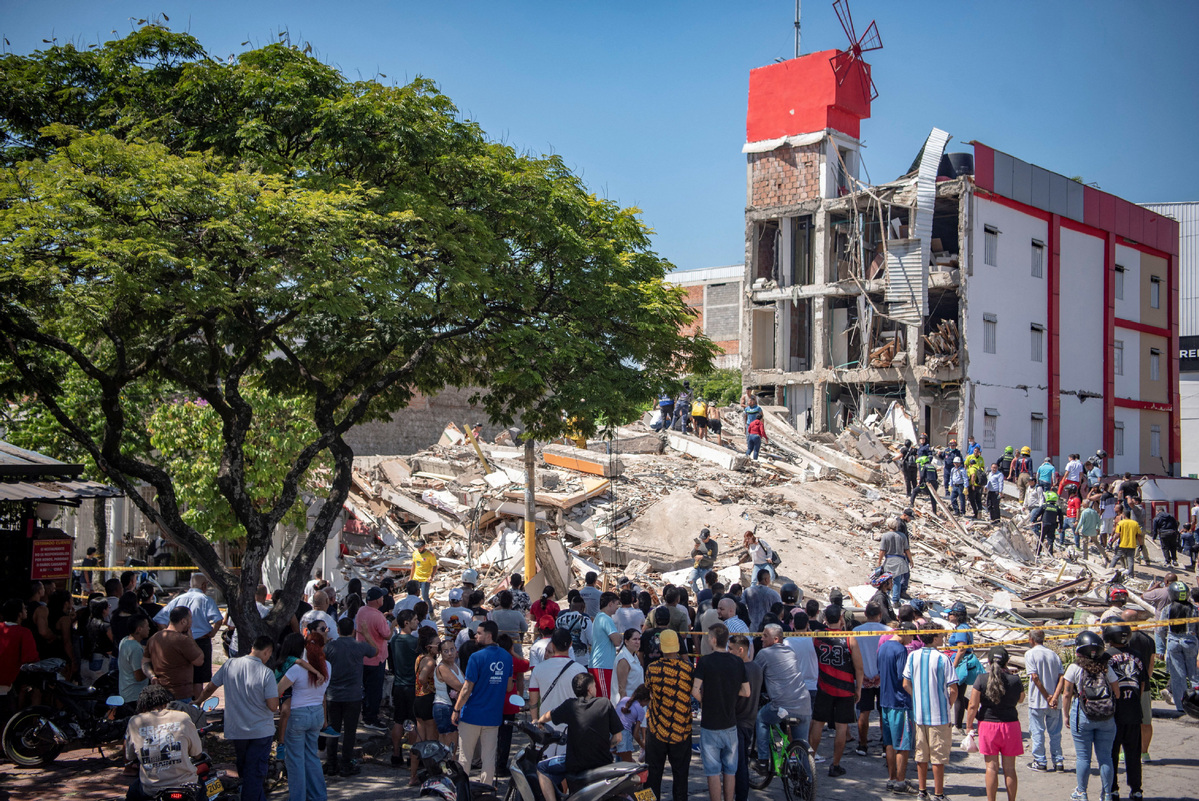
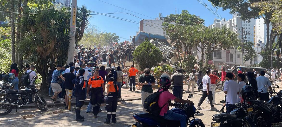
Colombian emergency workers, firefighters, police, medical professionals, volunteers and community members were all involved in the immediate response.
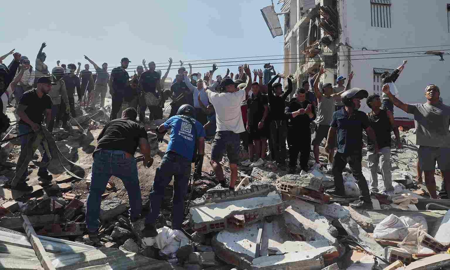
In several locations, residents also joined rescue efforts before heavy equipment arrived.
That community response is common in earthquakes around the world. The first people to reach a trapped survivor are often neighbors, family members or passersby rather than professional rescuers.
Why the Death Toll Keeps Changing
One of the most misunderstood aspects of breaking disaster coverage is the changing casualty number.
Within hours of a large earthquake, different authorities may publish different numbers.
One city may count confirmed deaths. Another may include presumed fatalities. A national emergency office may have information from only part of the country. Hospitals may report injured patients separately. Rescue teams may be searching collapsed buildings where nobody has yet been accounted for.
That is why Colombia’s reported death toll moved from dozens to more than 100 within the same day.
At one stage, major international reporting cited 111 deaths. Later Colombian reporting cited 132 deaths and 570 injuries.
These figures should not be treated as contradictory evidence of false reporting. Instead, they reflect the reality that disaster casualty accounting takes time.
The true toll can only become clearer after search operations, hospital records, missing-person reports and local government assessments are consolidated.

More Than Buildings Are Destroyed in an Earthquake
When people see earthquake photographs, they often focus on collapsed houses.
But buildings are only one part of the infrastructure system.
An earthquake can disrupt:
roads, bridges, electrical networks, telecommunications, water supply systems, hospitals, schools, airports, fuel distribution, banking operations and public transportation.
Reports from Colombia indicated damage across multiple categories of infrastructure, including disruptions at several airports.
Authorities suspended operations at airports including those serving Cali, Pereira, Manizales, Quibdó, Armenia, Cartago and Buenaventura while structural conditions were assessed.
This is important because airports become especially valuable during disasters. They can serve as lifelines for medical evacuations, emergency personnel, supplies and humanitarian assistance.
If an airport is closed because its runway, terminal or control facilities are damaged, the entire relief operation can become more complicated.
The Earthquake Also Disrupted Communications
Communication failures are among the most dangerous secondary effects of an earthquake.
People need phones to call relatives, request ambulances, report trapped survivors, and obtain information.
Emergency services need communications to coordinate operations.
Governments need communications to determine which areas have been reached and which remain isolated.
But severe shaking can damage cell towers, electricity systems, fiber-optic networks, roads and power infrastructure. Even when the physical network survives, millions of people suddenly attempting to call at the same time can overload the system.
In remote sections of Chocó, connectivity problems made it harder to assess the full extent of the destruction.
That creates an information vacuum.
And information vacuums are dangerous during disasters because rumors spread faster than verified information.
Aftershocks Are the Next Threat
The main earthquake is not necessarily the final earthquake.
After a major seismic event, the crust continues adjusting. This produces aftershocks, some of which can be strong enough to damage buildings that survived the main shock.
Reports indicated that numerous aftershocks followed the Colombian earthquake, with one later report citing 21 aftershocks.
That means people cannot automatically assume that a building is safe simply because it remained standing after the first event.
A structure may have suffered hidden internal damage: cracked columns, weakened beams, compromised foundations or damaged load-bearing walls.
The danger becomes greater when residents return too quickly to collect belongings.
Authorities generally advise people to stay away from visibly damaged structures until they are inspected by qualified professionals.
Why the Depth of the Earthquake Is Important
The reported depth of roughly 107 kilometers is one of the most scientifically interesting characteristics of this earthquake.
Depth influences how seismic energy spreads.
At shallow depths, intense shaking can be concentrated near the source, potentially producing extreme local destruction.
At greater depths, seismic waves can travel efficiently through the Earth’s crust and affect much wider geographic areas.
That does not mean deep earthquakes are harmless. Quite the opposite.
A deep earthquake can be felt across a vast region, affecting millions of people who live far from the epicenter.
That appears to have happened in Colombia. The earthquake was felt well beyond Chocó, including in major urban centers and even outside national borders.
The event therefore demonstrated that an earthquake’s “location” cannot be judged solely by looking at the point directly above the rupture.

Colombia’s Tectonic Setting Explains the Risk
Colombia is located in one of the world’s most geologically active regions.
The northern Andes are the product of a complicated interaction between major tectonic plates and smaller tectonic blocks.
To the west, the Nazca Plate moves beneath the South American Plate along the Pacific margin. The broader region is part of the highly active tectonic environment associated with the Pacific Ring of Fire.
To the northwest, Colombia also interacts with the Caribbean and surrounding tectonic systems.
This complex geometry means earthquakes are a natural part of Colombia’s geological reality.
The country has experienced destructive earthquakes before, including the devastating 1999 Armenia earthquake, which killed more than 1,000 people.
The August 2026 event is therefore not an isolated geological curiosity. It is part of a long-term seismic hazard confronting Colombia.
Why Building Quality Matters as Much as Magnitude
One of the most important lessons from every major earthquake is that the ground does not directly “choose” which buildings collapse.
Construction quality matters.
Buildings designed according to modern seismic standards are generally better positioned to withstand strong shaking than structures with weak structural systems, poor materials, illegal alterations, or inadequate reinforcement.
Two buildings standing next to each other can experience the same earthquake and emerge with completely different levels of damage.
That is why earthquake deaths are often described by engineers as partly a function of vulnerability, not just hazard.
The hazard is the earthquake itself.
The vulnerability is everything that determines how society responds to it.
And exposure is the number of people and structures located in the affected zone.
The final disaster is the interaction between those three factors.
Schools and Public Buildings Face Special Risks
Earthquakes affecting cities inevitably raise concerns about schools, universities, government buildings, hospitals and commercial structures.
Schools are particularly sensitive because children are concentrated in relatively large numbers in fixed locations.
A school that has not been assessed after a strong earthquake may pose a serious risk even if there are no visible cracks.
For this reason, post-earthquake inspections are crucial.
Authorities must determine whether buildings can be safely occupied, whether classrooms require temporary relocation, and whether structural damage has compromised stairways, columns, or roofs.
A disaster can therefore continue affecting education for weeks or months after the earthquake itself.
The same applies to government offices and businesses.
The Economic Damage Could Be Far Bigger Than the Initial Estimate
The human toll is the immediate tragedy.
The economic toll comes later.
A major earthquake can create costs across almost every sector of an economy.
Families lose homes.
Businesses lose inventories and equipment.
Factories may shut down.
Tourism suffers.
Transportation becomes more expensive.
Government spending rises dramatically.
Insurance claims increase.
Power and water networks require repairs.
Roads and bridges must be reconstructed.
Hospitals need replacement equipment.
Schools need repairs.
Small businesses that operate from damaged buildings may lose their income entirely.
And unlike large corporations, many small businesses do not have enough cash reserves to survive weeks or months of closure.
That means an earthquake can push vulnerable families into poverty long after international media attention disappears.
The Human Story Is Bigger Than the Death Toll
A disaster is often reduced to one number: the number of people killed.
But that number does not capture the full impact.
Consider the family whose home is destroyed.
Consider the child who cannot return to school.
Consider the elderly person who loses access to essential medication.
Consider the restaurant owner whose building collapses.
Consider the worker whose workplace disappears.
Consider the patient who has to be transferred from a damaged hospital.
Consider the families still trying to contact relatives in remote regions.
Earthquake recovery is therefore not merely an engineering exercise.
It is a social recovery process.
The psychological impact can also be profound.
People who survive a major earthquake may experience intense fear whenever they feel even a small vibration. Sleep can become difficult. Crowded indoor spaces may trigger anxiety. Parents may become afraid to let children sleep alone.
These effects rarely appear in the first casualty reports, but they are part of the disaster’s long-term human cost.
The Political Test for Colombia’s New Government
The earthquake also arrived at a politically significant moment.
President Abelardo de la Espriella had taken office only days before the disaster, making the earthquake his administration’s first major national emergency.
That immediately turned disaster management into a test of government capacity.
In a crisis, citizens judge governments on practical questions:
Can rescuers reach trapped people?
Are hospitals receiving supplies?
Are roads being reopened?
Are vulnerable families receiving temporary shelter?
Is information accurate?
Are emergency funds reaching affected communities?
Are damaged buildings being inspected?
And perhaps most importantly: is the government visibly present?
The Colombian president declared a national emergency and directed resources toward rescue and relief operations.
The coming weeks will reveal whether the administration can move effectively from emergency response to long-term reconstruction.
International Assistance Has Already Become Part of the Response
Large disasters rarely remain purely domestic emergencies.
International organizations, neighboring governments and foreign aid agencies can provide specialized support, medical teams, financial assistance, search-and-rescue equipment and humanitarian supplies.
Reports indicated that the United States committed $15.5 million in assistance, while countries including El Salvador, Mexico and Chile offered support.
Such assistance can be particularly valuable when specialized equipment is needed quickly.
But international aid works best when coordinated with local authorities and based on actual needs.
Sending unnecessary supplies can clog already damaged transportation systems.
The most effective disaster aid is often not the most visible. It is the assistance that fills a specific operational gap: rescue equipment, temporary medical capacity, clean water, shelter materials, communications support, or reconstruction financing.
Could This Earthquake Have Been Predicted?
No earthquake forecasting system can currently tell a population exactly when a major earthquake will strike with the precision people would need to evacuate safely.
Scientists can identify earthquake-prone regions and estimate probabilities over long time periods.
But a prediction such as “a magnitude 7.4 earthquake will happen tomorrow at 7:34 a.m.” is not presently possible in the reliable operational sense required for public safety.
That makes preparedness critical.
The real goal of earthquake science is therefore not to predict every earthquake.
It is to reduce the number of people killed when earthquakes happen.
That means stronger buildings, better land-use planning, emergency drills, public education, early warning where technically feasible, resilient communication systems and rapid-response teams.
What Earthquake Early Warning Can and Cannot Do
Earthquake early warning is sometimes misunderstood as earthquake prediction.
It is not.
Earthquake early-warning systems detect an earthquake after it begins and can sometimes send alerts before the strongest shaking arrives at more distant locations.
Because earthquake waves travel through the ground at finite speeds and electronic signals can travel much faster, those seconds can matter.
Even a short warning may allow:
trains to slow down;
industrial machinery to shut off;
elevators to stop safely;
hospital procedures to pause;
people to move away from obvious hazards.
But people closest to the epicenter may receive little or no warning because the strongest shaking arrives too quickly.
Therefore, early warning is an additional layer of protection, not a substitute for earthquake-resistant construction.
What People in Affected Areas Should Do After a Major Earthquake
The most important post-earthquake rule is simple: do not assume the danger has ended when the shaking stops.
People should remain alert for aftershocks.
They should avoid damaged buildings, fallen power lines, unstable walls and areas affected by landslides.
Gas leaks and electrical faults can create secondary fires.
Residents should also follow official emergency instructions rather than relying on viral social-media claims.
For families trying to locate relatives, text messages can sometimes work when voice calls fail because they require less network capacity.
People should also conserve phone batteries and avoid unnecessary calls.
In earthquake zones, information itself becomes a survival resource.
Why Social Media Can Help—and Hurt
Social media becomes extremely important during disasters because eyewitnesses can publish information faster than traditional media.
Videos can show damaged buildings.
Residents can identify blocked roads.
Families can search for missing relatives.
Emergency organizations can post instructions.
But social media also creates serious risks.
Old earthquake videos can be reposted as new.
Unverified casualty numbers can spread within minutes.
Fake rescue requests can appear.
Misleading claims about aftershocks can cause panic.
Therefore, responsible journalism requires separating what has been verified from what is merely circulating online.
For TheAshNow, that distinction matters.
A professional news organization should never increase an earthquake casualty number simply because a viral post claims it.
The correct approach is to identify the source, assess its credibility, and report uncertainty honestly.
The Biggest Lesson Is Not the Magnitude—It Is Preparedness
The Colombian disaster once again demonstrates that earthquakes are not just geological events.
They are tests of infrastructure.
They are tests of governance.
They are tests of emergency medicine.
They are tests of communication.
They are tests of building standards.
And, ultimately, they are tests of society’s preparedness.
A magnitude 7.4 earthquake cannot be stopped.
But deaths can be reduced.
Collapsed buildings can be prevented.
Hospitals can be strengthened.
Emergency communications can be made more resilient.
Communities can be trained.
Search-and-rescue teams can be expanded.
Building codes can be enforced.
And citizens can be taught what to do before, during, and after the shaking.
That is where the world’s attention should turn once the immediate rescue phase is over.

Colombia’s Long Road From Rescue to Recovery
The rescue phase will dominate the first days.
Then comes recovery.
Then reconstruction.
Those stages can last months or years.
Families who lost homes will need temporary shelter first and permanent housing later.
Damaged hospitals and schools will have to be repaired or rebuilt.
Roads and bridges must be restored.
Businesses need financial assistance.
Municipalities will need additional budgets.
Engineers will need to inspect thousands of structures.
Governments will need to decide whether certain buildings should be retrofitted or demolished.
Insurance companies will face an enormous volume of claims.
And communities will have to rebuild not only physical structures but their sense of security.
The central question for Colombia will therefore not simply be: How quickly can the rubble be removed?
It will be: Can the country rebuild in a way that is safer than what existed before the earthquake?

A Disaster That Colombia Will Remember
The August 10, 2026 earthquake will likely be remembered not only for its 7.4 magnitude, but for the breadth of its impact.
From Chocó to Cali, from Pereira to Manizales, the shaking reached communities across western Colombia.
Buildings collapsed.
Hospitals were disrupted.
Airports were temporarily affected.
Families were separated.
Rescue teams entered unstable structures.
Volunteers dug through rubble.
And an entire country watched the numbers change as the scale of the disaster became clearer.
The latest casualty reports already place the deaths in the hundreds and injuries in the hundreds, but the final human toll will depend on the completion of search operations and the consolidation of official records.
The full consequences will take much longer to measure.
For now, the priority remains unmistakable: find survivors, treat the injured, protect displaced families, restore essential services and prevent further deaths from secondary hazards.
Frequently Asked Questions (FAQs)
What caused the 7.4 magnitude earthquake in Colombia?
The powerful earthquake was caused by the movement of tectonic plates beneath western Colombia. The country lies in one of the world’s most seismically active regions, where the Nazca Plate is subducting beneath the South American Plate. This constant geological movement builds up stress over time, and when that stress is suddenly released, it generates an earthquake. The August 2026 event occurred at a depth of approximately 107 kilometers, allowing seismic waves to travel across a wide region. While scientists can identify earthquake-prone zones, they cannot accurately predict the exact date, time, or magnitude of such events.
Which cities were affected by the Colombia earthquake?
The earthquake was felt across a large part of Colombia, with severe impacts reported in Cali, Pereira, Chocó, Quibdó, Manizales, Armenia, Cartago, Buenaventura, and nearby areas. Several buildings collapsed, roads were damaged, hospitals activated emergency protocols, and rescue teams were deployed across multiple departments. Tremors were also reported in neighboring countries, including Ecuador, Panama, and Venezuela, highlighting the widespread reach of the earthquake.
Why did a deep earthquake cause so much destruction?
Although the earthquake originated at a depth of around 107 kilometers, its 7.4 magnitude released an enormous amount of energy. Deep-focus earthquakes generally affect a much larger geographical area because seismic waves travel farther through the Earth’s crust. The level of destruction also depends on factors such as population density, construction quality, soil conditions, and infrastructure resilience. In densely populated cities with older or vulnerable buildings, even a deep earthquake can result in catastrophic damage and significant casualties.
Is Colombia at high risk of earthquakes?
Yes. Colombia is considered one of the most earthquake-prone countries in South America due to its location along the Pacific Ring of Fire, a region responsible for nearly 90% of the world’s earthquakes. The interaction of the Nazca, South American, and Caribbean tectonic plates makes earthquakes a recurring natural hazard. Colombia has experienced several destructive earthquakes throughout its history, prompting continuous improvements in seismic building codes, emergency preparedness, and disaster response systems.
What should people do during and after a major earthquake?
During an earthquake, experts recommend following the “Drop, Cover, and Hold On” principle. Stay away from windows, heavy furniture, and objects that could fall. If you are outdoors, move to an open area away from buildings, bridges, trees, and power lines. After the shaking stops, expect aftershocks, evacuate damaged structures if it is safe to do so, check for injuries, avoid using elevators, and follow instructions issued by local emergency authorities. It is also important to keep an emergency kit with drinking water, food, medicines, a flashlight, batteries, and important documents ready in earthquake-prone regions.
The Bottom Line
The Colombia earthquake is a powerful reminder that a disaster is never measured by magnitude alone.
A 7.4 earthquake is a major seismic event, but the devastation comes from the interaction between geological forces and human vulnerability.
The earthquake struck western Colombia early in the morning, centered near San José del Palmar in Chocó, at a depth of about 107 kilometers. Its shaking reached major cities, while serious structural damage and casualties were reported across several departments.
As of the latest reports, more than 100 people have been confirmed dead, hundreds have been injured, more than 1,500 homes have reportedly been affected, and dozens of buildings have completely collapsed. However, these figures remain subject to revision as authorities continue their assessments.
The immediate story is rescue.
The next story will be recovery.
The story after that will be whether Colombia turns tragedy into stronger preparedness.
Because earthquakes cannot be prevented.
But the scale of human suffering they cause can be reduced.
And that may ultimately be the most important lesson emerging from Colombia’s devastating August 2026 earthquake.

Editor’s note: This article reflects information available from major international and Colombian reports as of the latest verified updates. Earthquake casualty figures can change rapidly during rescue operations, so early numbers should always be treated as provisional.
This is a developing story. TheAshNow will continue to track verified developments as Colombian authorities and emergency agencies update casualty, damage, rescue and recovery figures.
Top International Sources Covering the Colombia Earthquake
- Associated Press (AP News)
One of the world’s most trusted news agencies. AP provides verified updates on the earthquake’s magnitude, epicenter, casualties, rescue operations, government response, and international aid. (AP News) - Reuters
Reuters offers reliable breaking news with verified seismic information, official government statements, and updates from emergency agencies and seismological organizations. (Reuters) - ABC News
Comprehensive coverage focusing on fatalities, collapsed buildings, search-and-rescue efforts, and the national emergency declared by Colombian authorities. (ABC News) - The Guardian
Detailed reporting on the humanitarian impact, damage across cities like Cali and Pereira, airport disruptions, aftershocks, and the government’s response. (The Guardian) - TIME
Explains the science behind the earthquake, why Colombia is earthquake-prone, the latest casualty figures, infrastructure damage, and frequently asked questions for readers. (TIME) - Al Jazeera
Provides a live timeline of events with continuous updates on rescue operations, official announcements, and humanitarian developments. (Al Jazeera) - U.S. Geological Survey (USGS) Earthquake Program
The authoritative scientific source for earthquake data, including magnitude, depth, epicenter location, tectonic analysis, and real-time seismic monitoring.
Disclaimer
The information presented in this article is based on reports from official government agencies, emergency authorities, seismic organizations, and internationally recognized news sources available at the time of publication. As the situation continues to develop, details such as casualty figures, injuries, missing persons, and damage assessments may change as rescue operations progress and authorities release updated information.
TheAshNow is committed to responsible journalism and strives to publish accurate, verified, and up-to-date information. Any estimates or preliminary figures mentioned in this article should be considered provisional until officially confirmed by the relevant authorities.
This article is intended solely for informational and educational purposes and should not be considered official emergency guidance. Readers in affected areas are advised to follow instructions issued by local governments, disaster management agencies, and emergency services.