
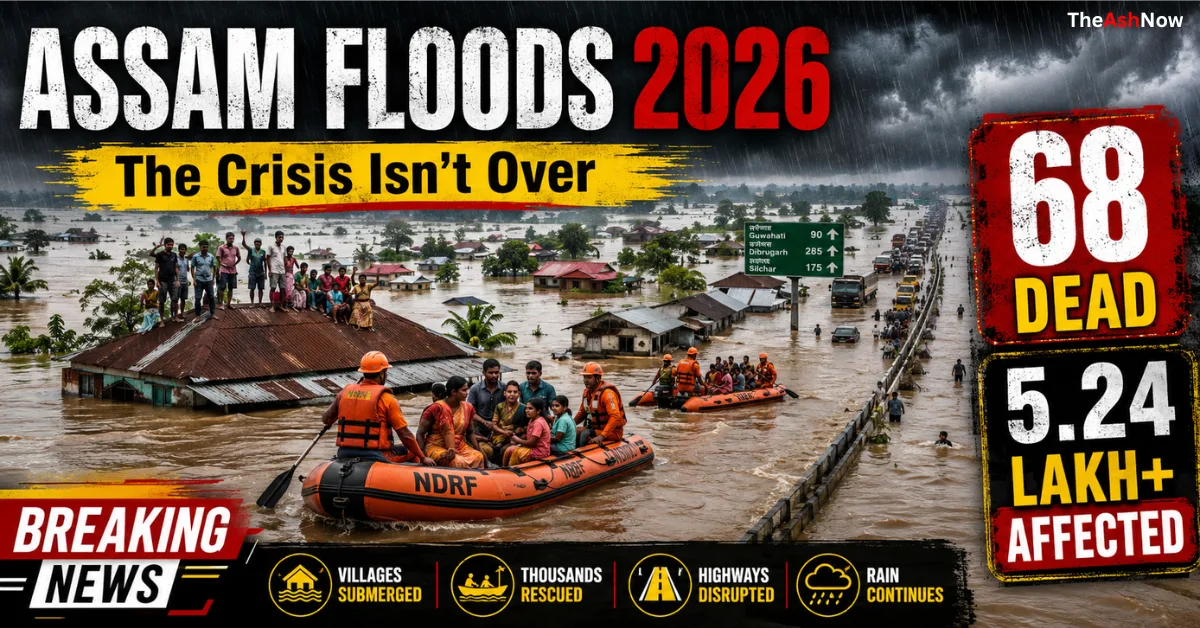
Assam Floods 2026: Every year, millions of people in Assam prepare for a season they know all too well—the monsoon. For many, the arrival of rain is no longer associated with prosperity or agriculture alone; it has become a season of uncertainty, displacement, and survival.
The 2026 Assam floods have once again demonstrated how one of India’s most fertile regions can quickly transform into a humanitarian crisis. Entire villages have disappeared beneath floodwaters, highways have been submerged, schools have become temporary shelters, and thousands of families have been forced to leave everything behind.
Although the floodwaters have started receding in several districts, the crisis is far from over. The recovery phase has only begun, and rebuilding lives will take months.
Table of Contents
Your Leadership Story Deserves the Spotlight
Get featured on TheAshNow — the editorial platform trusted by founders, CEOs & executives worldwide for Google visibility, LinkedIn authority & global recognition.
Apply for Featured Profile →The Situation on the Ground
The latest data released by the Assam State Disaster Management Authority (ASDMA) paints a picture of gradual improvement, but the scale of destruction remains enormous.
As of 27 July 2026:
- 68 people have lost their lives in flood-related incidents.
- More than 5.24 lakh people continue to be affected.
- 763 villages remain under floodwater.
- 48,742 hectares of agricultural land have been damaged.
- Over 88,000 livestock and poultry have been affected.
- 37,724 displaced people are staying in relief camps and relief distribution centres.
- Numerous roads, embankments, bridges, schools and public infrastructure have suffered damage.
While these numbers help quantify the disaster, they only tell part of the story.
A Disaster That Unfolded in Phases
Unlike flash floods, Assam’s floods developed over several days.
Continuous heavy rainfall across:
- Assam
- Arunachal Pradesh
- Meghalaya
- Bhutan
fed enormous quantities of water into the Brahmaputra River and its tributaries.
Initially, rivers began flowing above the danger level.
Soon afterwards:
- embankments were overtopped in some locations,
- low-lying villages disappeared under water,
- roads became impassable,
- electricity failed,
- communication networks weakened,
- rescue teams struggled to reach isolated communities.
During the peak of the crisis earlier this week, more than seven lakh people were affected before water levels gradually started falling.
Charaideo: The Worst-Hit District
Among all affected districts, Charaideo emerged as the epicentre of the disaster.
BUILD YOUR LEGACY IN PRINT
Editorial features for founders, CEOs & executives — engineered for search visibility, LinkedIn credibility & industry authority.
APPLY NOW →Nearly 1.9 lakh residents were affected in this district alone.
Many villages remained surrounded by water for days.
Two additional drowning deaths reported from Sonari in Charaideo pushed the statewide death toll to 68.
Sivasagar: Relief Camps Filled Beyond Capacity
Sivasagar witnessed one of the largest humanitarian operations.
According to official figures:
- 66 relief camps are operating in the district.
- More than 30,000 displaced people are living inside these camps.
Schools, community buildings and public facilities have been converted into temporary shelters where families receive food, drinking water and medical assistance.
Jorhat and Golaghat Continue to Face Serious Challenges
Although water levels have begun to decline, large parts of Jorhat and Golaghat remain affected.
Many villages continue to experience:
- damaged roads,
- contaminated drinking water,
- limited transport,
- disrupted healthcare,
- loss of crops.
The Dhansiri River at Numaligarh has remained above the danger level, prompting authorities to advise residents to stay away from riverbanks.
What Is Life Like Inside the Flood Zone?
For residents, the flood is not simply an environmental event—it changes every aspect of daily life.
Families often evacuate with only a few belongings.
Furniture, food supplies, clothing, school books, and important documents are frequently left behind.
Many homes, particularly bamboo and wooden structures, remain submerged for days. Even when the water recedes, thick layers of mud and silt make houses temporarily uninhabitable.
Clean drinking water becomes scarce because hand pumps and wells are contaminated by floodwater.
Medical teams also monitor the risk of:
- diarrhoeal diseases,
- skin infections,
- mosquito-borne illnesses,
- snake bites.
Children face interrupted schooling, while elderly residents often require continuous medical care in relief camps.
Farmers Face Months of Recovery
Agriculture has suffered one of the biggest blows.
Large areas of paddy cultivation remain underwater.
Floods have destroyed:
- standing crops,
- seed storage,
- irrigation systems,
- fish ponds,
- livestock shelters.
For many small farmers, this represents an entire year’s income.
The official assessment estimates 48,742 hectares of cropland have been damaged so far.
Livestock Losses Add to Rural Hardship
Floods affect not only people but also animals.
According to official figures:
- 88,240 domestic animals and poultry have been impacted.
For rural families, cattle, goats and poultry are essential sources of income and food security. Their loss deepens the economic impact of the disaster.
Massive Rescue Operations
As floodwaters rose rapidly, multiple agencies launched coordinated rescue operations.
These included:
- Indian Army
- National Disaster Response Force (NDRF)
- State Disaster Response Force (SDRF)
- Assam Police
- Fire & Emergency Services
- District Administrations
- Local volunteers
Earlier in the emergency, the Army launched Operation Jal Rahat, deploying rescue boats and helicopters to evacuate stranded residents in Upper Assam. Hundreds of people were rescued from inaccessible areas, particularly in Sivasagar and Charaideo.
Government Response
Chief Minister Himanta Biswa Sarma has said that the state government is prioritising:
- restoration of electricity,
- repair of roads,
- rehabilitation of affected communities,
- continued relief distribution.
As water levels recede, electricity restoration is being carried out in phases while damage assessments continue.

Why Does Assam Keep Flooding?
A single factor does not cause flooding in Assam.
It is the result of geography, climate, and human activity.
1. The Brahmaputra’s Enormous Water Volume
The Brahmaputra is among the world’s largest rivers by discharge. During the monsoon, it carries water from Tibet, Arunachal Pradesh, Bhutan, and Northeast India.
2. Heavy Sediment Load
The river transports huge amounts of silt and sand, raising the riverbed over time and reducing its capacity.
3. Hundreds of Tributaries
Numerous tributaries empty into the Brahmaputra almost simultaneously during heavy rain.
4. Climate Change
Scientists have observed increasingly erratic monsoon behaviour across South Asia, with shorter but more intense rainfall events increasing flood risk.
5. Riverbank Erosion
Entire villages are gradually lost as the Brahmaputra changes course year after year.
Kaziranga National Park Also Under Threat
Flooding extends beyond human settlements.
Kaziranga National Park experiences annual flooding, which is ecologically important but can become dangerous during extreme events.
Animals such as:
- one-horned rhinoceroses,
- elephants,
- deer,
- wild buffalo,
move toward higher ground, often crossing highways where they face the risk of vehicle collisions.

The Economic Cost
Floods have affected nearly every sector:
| Sector | Impact |
|---|---|
| Agriculture | Crop destruction and income loss |
| Transport | Roads and bridges damaged |
| Education | Schools converted into relief camps |
| Health | Increased disease risk |
| Tourism | Reduced visitor activity |
| Local Businesses | Temporary closures |
| Infrastructure | Embankment and power network damage |
The full financial cost will only become clear after detailed government assessments.
Recovery Will Take Months
Although floodwaters are receding, the emergency is entering a new phase.
Authorities must now focus on:
- cleaning villages,
- restoring safe drinking water,
- repairing schools,
- rebuilding roads,
- compensating affected families,
- restoring agriculture,
- preventing disease outbreaks.
For many communities, returning to normal life will take months rather than weeks.

Looking Ahead
Assam’s annual floods cannot be eliminated because they are closely tied to the natural behaviour of the Brahmaputra River. However, experts argue that their impact can be reduced through stronger embankments, better river-basin management, improved flood forecasting, wetland conservation, resilient infrastructure, and coordinated land-use planning. As climate change increases the likelihood of extreme rainfall, these long-term measures are becoming even more critical.
FAQs About Assam Floods 2026
What caused the Assam floods in 2026?
The 2026 Assam floods were caused by a combination of intense monsoon rainfall across Assam, Arunachal Pradesh, Meghalaya, and Bhutan, which significantly increased water levels in the Brahmaputra River and its tributaries. The situation was worsened by overflowing rivers, sediment (silt) accumulation that reduces river capacity, riverbank erosion, and localized infrastructure failures. Experts also point to increasingly erratic rainfall patterns linked to climate change as a contributing factor.
How many people were affected by the Assam floods in 2026?
According to the Assam State Disaster Management Authority (ASDMA), more than 5.24 lakh (524,000+) people were affected across multiple districts. At the peak of the disaster, the number of affected residents exceeded seven lakh before floodwaters began to recede in several regions. Hundreds of villages remained submerged, and thousands of families were displaced to government relief camps.
Which districts were worst affected by the Assam floods?
The worst-affected districts included:
Charaideo
Sivasagar
Jorhat
Golaghat
Nagaon
Dhemaji
Dibrugarh
Majuli (river island)
Among these, Charaideo and Sivasagar experienced some of the most severe flooding, with widespread inundation, damaged infrastructure, and large-scale evacuations.Why does Assam experience floods almost every year?
Assam’s annual floods are primarily due to its unique geography. The Brahmaputra River, one of the world’s largest rivers by water discharge, flows through the state and receives water from hundreds of tributaries. During the monsoon, heavy rainfall in the Himalayas and Northeast India rapidly increases river levels. Continuous silt deposition raises the riverbed, reducing its capacity and causing overflow. Flooding is therefore a recurring natural phenomenon, although human activities and climate change have intensified its impact.
Is climate change making Assam floods more severe?
Many climate scientists believe climate change is increasing the frequency and intensity of extreme rainfall events across South Asia. Warmer temperatures allow the atmosphere to hold more moisture, leading to heavier downpours over shorter periods. While Assam has always experienced seasonal flooding, changing climate patterns are believed to be making these events more unpredictable and destructive.
How many people died in the Assam floods of 2026?
As of late July 2026, at least 68 people had lost their lives due to flood-related incidents, including drowning, landslides, electrocution, and other flood-associated accidents. Authorities have noted that the death toll may change as rescue operations and damage assessments continue.
What is the role of the Brahmaputra River in Assam’s floods?
The Brahmaputra River is the primary reason Assam experiences extensive flooding. It carries enormous volumes of water and sediment from Tibet, Arunachal Pradesh, Bhutan, and Northeast India. During the monsoon, heavy inflows from numerous tributaries can exceed the river’s carrying capacity, causing widespread overflow into nearby floodplains and settlements.
How are rescue and relief operations being carried out?
Rescue operations are being coordinated by multiple agencies, including:
National Disaster Response Force (NDRF)
State Disaster Response Force (SDRF)
Indian Army
Assam Police
Fire & Emergency Services
Local administration and volunteers
These teams have deployed rescue boats, temporary shelters, medical camps, food supplies, drinking water, and emergency healthcare to assist affected communities. Helicopters and specialised rescue equipment have also been used in inaccessible areas.How have the Assam floods affected agriculture and the local economy?
Floods have submerged tens of thousands of hectares of agricultural land, destroying paddy fields, vegetables, fisheries, and livestock. Many farmers have lost an entire season’s income. Beyond agriculture, roads, bridges, schools, electricity infrastructure, and local businesses have also suffered extensive damage, leading to significant economic losses and prolonged recovery efforts.
How are Assam’s wildlife and Kaziranga National Park affected?
Flooding significantly impacts wildlife, particularly in Kaziranga National Park, a UNESCO World Heritage Site. Rising waters force animals such as the one-horned rhinoceros, elephants, deer, wild buffalo, and tigers to move toward higher ground. During these migrations, many animals cross highways, increasing the risk of road accidents. While seasonal flooding is ecologically beneficial for the park’s grasslands, extreme floods can threaten wildlife survival.
Can Assam floods be prevented completely?
No. Experts agree that Assam’s floods cannot be completely prevented because flooding is a natural characteristic of the Brahmaputra River system. However, the impact can be significantly reduced through improved flood forecasting, stronger embankments, scientific river management, wetland conservation, sustainable urban planning, better drainage systems, and climate-resilient infrastructure.
Why is riverbank erosion a major problem in Assam?
Riverbank erosion is one of Assam’s biggest environmental challenges. Every year, the Brahmaputra changes its course, washing away fertile farmland, homes, schools, roads, and entire villages. Thousands of families lose their land permanently and are forced to relocate, creating long-term economic and social challenges even after floodwaters recede.
What challenges do flood survivors face after the water recedes?
The end of flooding marks the beginning of a long recovery process. Survivors often face:
Contaminated drinking water
Waterborne diseases
Damaged homes
Loss of crops and livestock
Interrupted education
Poor sanitation
Limited healthcare access
Psychological trauma
Financial hardship
Rehabilitation and reconstruction can take several months.How is the government helping flood-affected communities?
The Government of Assam and the Government of India have established relief camps, distributed food and drinking water, deployed medical teams, restored damaged infrastructure, evacuated stranded residents, and begun assessing compensation for affected families. Disaster management agencies continue to monitor river levels and coordinate rehabilitation efforts as waters recede.
What long-term solutions could reduce future flood damage in Assam?
Experts recommend a combination of structural and environmental measures, including:
Integrated Brahmaputra river basin management
Modern flood forecasting and early warning systems
Strengthening embankments where appropriate
Restoration of wetlands and natural floodplains
Afforestation in upstream catchments
Scientific dredging where justified
Climate-resilient infrastructure
Planned urban development
Community-based disaster preparedness
Cross-border cooperation on river management
While no single solution can eliminate flooding, a combination of these strategies can substantially reduce loss of life and economic damage during future monsoon seasons.
Conclusion
The Assam Floods of 2026 are more than a seasonal disaster—they are a reminder of the immense challenges faced by communities living along one of the world’s most dynamic river systems. While rescue teams have saved thousands of lives and water levels are gradually falling, the crisis is far from over. Hundreds of villages remain inundated, livelihoods have been disrupted, and families are beginning the difficult task of rebuilding.
The coming months will determine not only how quickly Assam recovers, but also how effectively governments and communities prepare for the next monsoon. Sustainable river management, climate adaptation, resilient infrastructure, and timely disaster response will be essential if the cycle of devastation is to be reduced in the years ahead.

Sources
- Assam State Disaster Management Authority (ASDMA) – Daily Flood Reports, Press Releases & Situation Updates.
https://asdma.assam.gov.in/ (ASDMA) - India Meteorological Department (IMD) – Weather Bulletins and Heavy Rainfall Forecasts.
https://mausam.imd.gov.in/ - National Disaster Management Authority (NDMA), Government of India – Disaster management guidelines and preparedness.
https://ndma.gov.in/ - Central Water Commission (CWC) – River water level monitoring and flood forecasts.
https://cwc.gov.in/ - Government of Assam – Chief Minister’s Office – Official flood updates and relief information. (Facebook)
- ReliefWeb (United Nations OCHA) – Situation reports and humanitarian updates. (ReliefWeb)
- The Associated Press (AP News) – Independent international reporting on the Assam floods. (AP News)
- The Times of India – Ground reports and daily flood updates. (The Times of India)
Disclaimer: This article is intended for informational and educational purposes only. It is based on official government updates, disaster management authorities, weather agencies, and reputable national and international news reports available at the time of publication. Flood situations evolve rapidly, and official figures—including casualties, affected population, and damage assessments—may change as rescue, relief, and verification efforts continue. Readers are advised to refer to the latest updates from the Assam State Disaster Management Authority (ASDMA), the India Meteorological Department (IMD), the National Disaster Management Authority (NDMA), and local government authorities for the most current information.






[…] Assam Floods 2026: When the Brahmaputra Turns Into a Sea […]